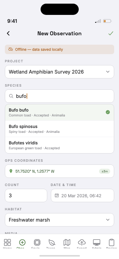
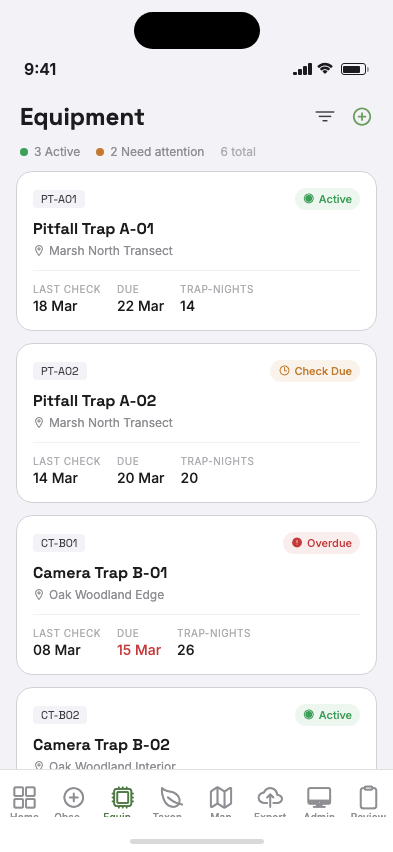
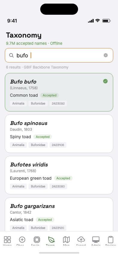
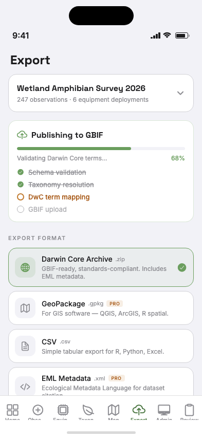
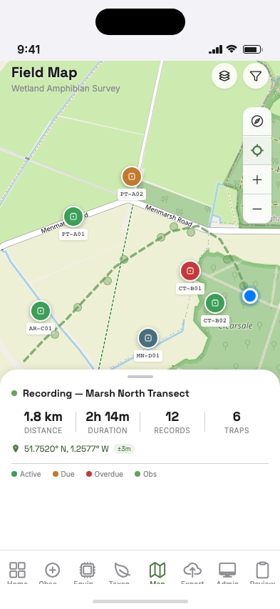
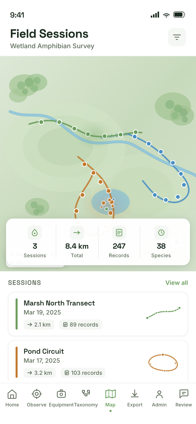
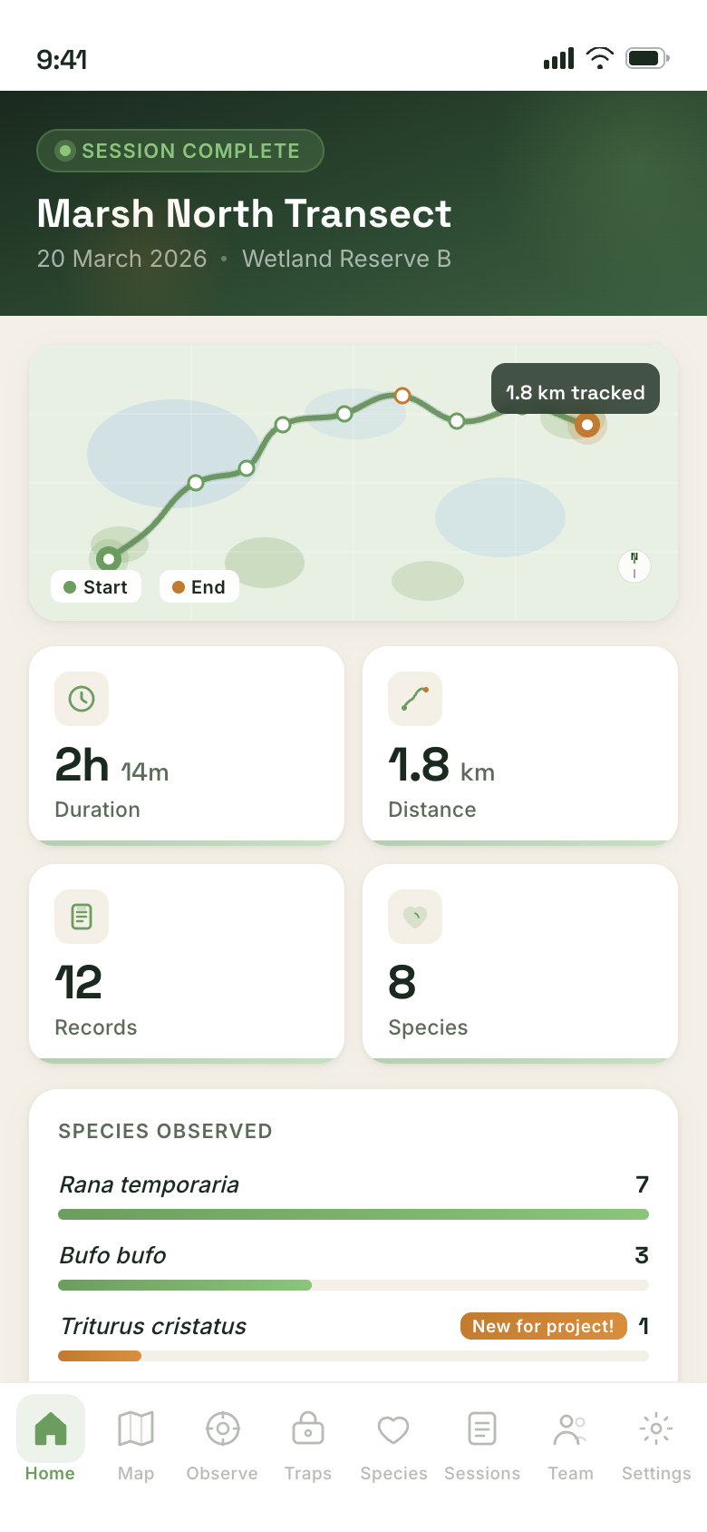
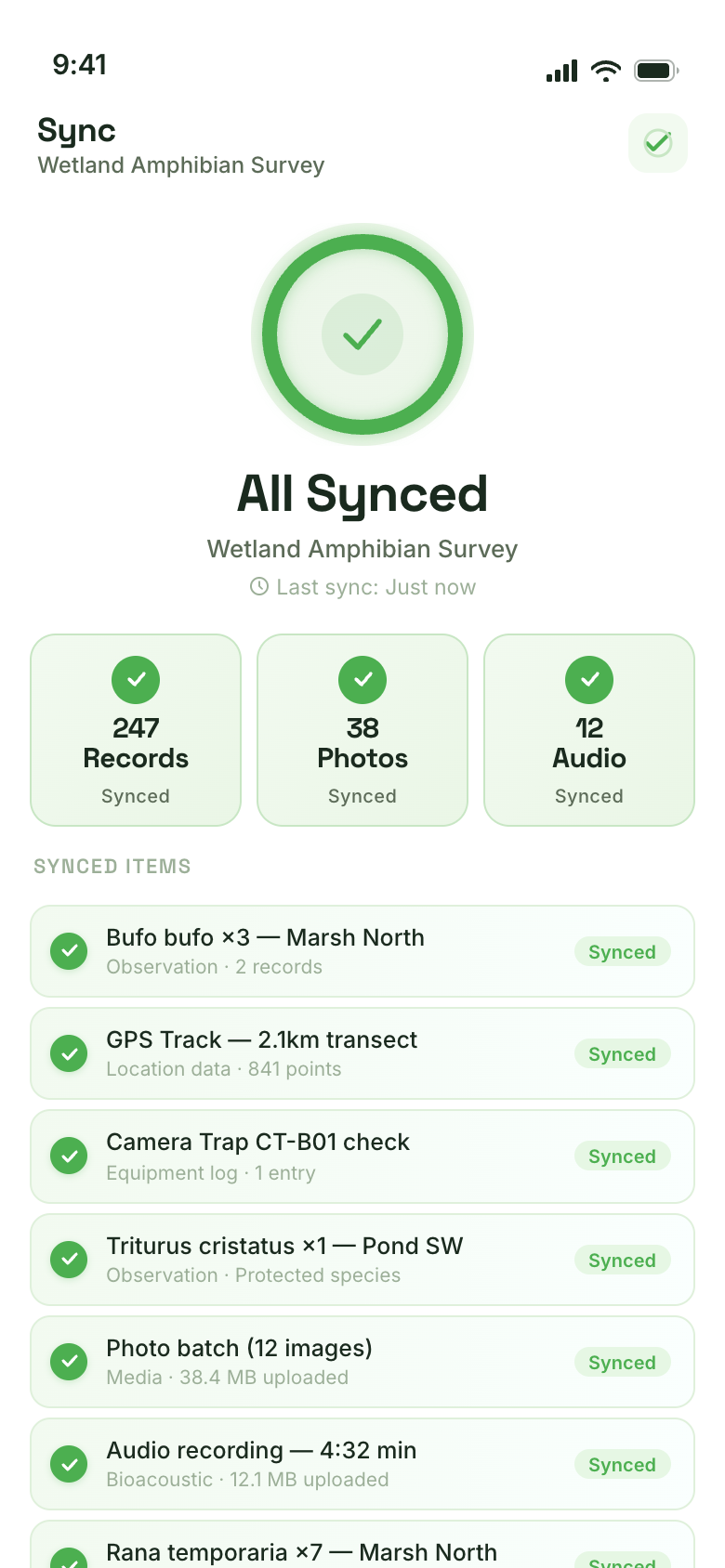
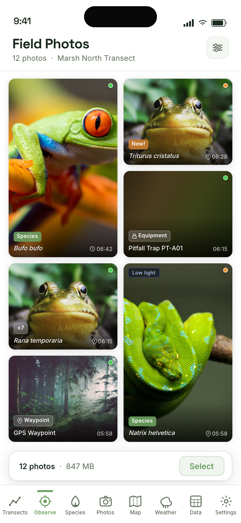
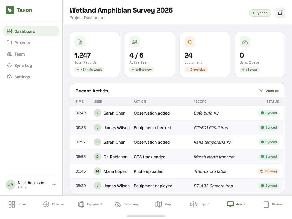
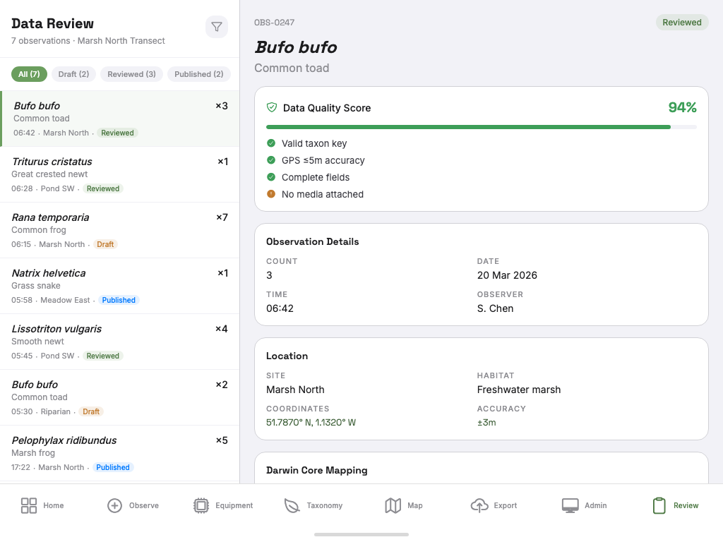
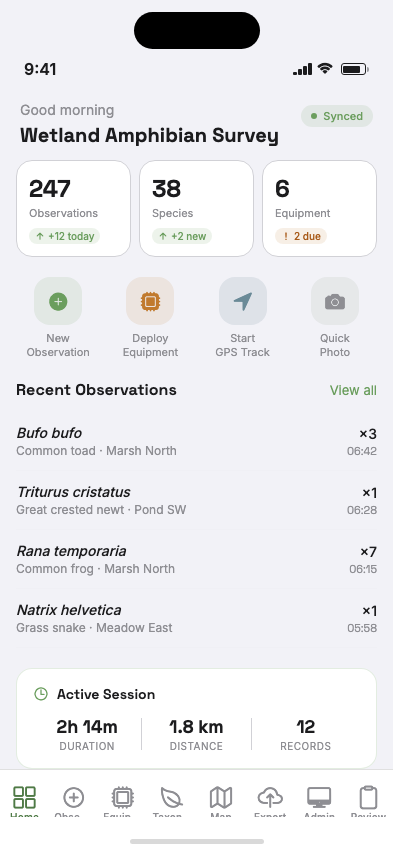
We're building the only offline-first app designed for field ecologists. Capture species observations once — export to Darwin Core, GBIF, your local records centre, or whatever your workflow needs. No reformatting.
We're recruiting field ecologists to shape what we build. Your feedback drives the roadmap.
You're on the list.
We'll be in touch with updates and early access opportunities. Check your email for a confirmation.
Design preview — in development
The Problem
You're collecting data in rain, mud, and darkness with gloves on — then spending evenings manually re-entering it into spreadsheets, arguing with Excel, and losing confidence in your own records. When you finally need to publish, your data doesn't meet Darwin Core standards. You start over.
Connectivity
Standard survey apps require a connection to save. Lose signal in the field — lose your records. Taxon works completely offline, syncing when you're ready.
Data standards
Hours reformatting for GBIF, your local records centre, or a client deliverable. Every destination wants different columns, coordinates, and metadata. Taxon captures data once and exports to all of them.
Equipment tracking
Camera traps, pitfall traps, acoustic recorders — no dedicated tool tracks their deployment, check intervals, and recovery. Until now.
What We're Building
Core Feature
Taxon stores all observations locally on your device using a reliable SQLite database. GPS coordinates, photos, audio recordings, species identifications, and equipment logs — all captured offline and synced when you next reach connectivity.
In developmentUnique to Taxon
Log deployment date, GPS location, equipment settings, and expected check intervals. Get flagged when checks are overdue. Record recovery condition, catch data, and effort metrics.
In development
Scientific Precision
Search the GBIF taxonomy backbone as you type — accepted names, offline. Taxon auto-completes accepted names, flags synonyms, and links every observation to a stable taxonKey.
In developmentPublication Ready
Taxon structures your data from the first keystroke. Export a Darwin Core Archive for GBIF, a Shapefile for planning authorities, CSV for R or Python, GeoPackage for QGIS, or custom templates for your local records centre. One capture, every destination.
In development — Q2 2026
See It In Action
From GPS-tracked field transects on your phone to team dashboards on your laptop — Taxon adapts to how you work.
Field Map — Live GPS tracks with equipment markers
Field Sessions — Multi-session GPS tracks with species hotspots
Session Summary — End-of-day stats, species, and transect map
Sync Complete — 247 records synced with zero conflicts
Field Photos — Species-tagged photo gallery with GPS metadata and quality indicators
Project Dashboard — Team activity, sync status, and equipment metrics at a glance
Data Review — Quality scoring, Darwin Core mapping, and approve-to-publish workflow
The Workflow
Three steps. No manual formatting. No data loss.
Log species observations, equipment deployments, GPS tracks, photos, and audio. Works on any iOS or Android device, completely offline.
Works without internetReturn to signal and Taxon pushes your records to the cloud with conflict-aware merging. Multiple team members can sync from separate devices.
Conflict-free team syncDarwin Core Archive for GBIF. Shapefiles for planning authorities. CSV for R and Python. GeoPackage for QGIS. Custom templates for your local records centre. One capture, every format.
Flexible multi-format exportPilot Program — Recruiting
We want to get Taxon into real field conditions as early as possible. We're recruiting three pilot groups to co-design the app and test it where it matters — in the mud, rain, and darkness.
Temperate woodland, Europe
Offline species capture, NVC plot recording, and data quality validation against existing paper-based workflows.
Apply for this slotUpland streams, remote sites
Offline-first capture at sites with no mobile connectivity. Focus: whether the app survives real field conditions and syncs reliably.
Apply for this slotPhase 1 habitat surveys
Phase 1 habitat survey workflows, regulatory-ready exports, and Shapefile delivery for planning authority submissions.
Apply for this slotAll pilot slots include free access, direct roadmap input, and dedicated support.
Built For
Free access for early testers. Standardized data from day one means no data cleaning hell before your methods paper.
Run multiple concurrent projects with field teams. Team sync, conflict resolution, and role-based access ensure data integrity across sites.
Run Phase 1 habitat surveys and protected species surveys with protocols that meet statutory requirements. Export in formats your clients expect.
Govern your lab's field data pipeline. Manage team access, review sync logs, and maintain the audit trail funders require.
Building on Open Standards
Taxon implements Darwin Core Term definitions as specified by TDWG, with export to Darwin Core Archive, Shapefile, GeoPackage, CSV, and custom templates. Whether your data goes to GBIF, the NBN Atlas, a local records centre, or a planning authority — we're building the export to match.
Development Roadmap
Priorities informed by what field ecologists actually need.
Join the Pilot Program
Pilot participants get free access, direct input on the roadmap, and dedicated support. We review applications weekly.
We'll review your application and be in touch within 5 business days. In the meantime, check your email for a confirmation.
Questions
We're targeting Q2 2026 for our first pilot testers. We're prioritizing data integrity and standards compliance before opening broader access. Sign up above to be notified.
Not yet — the app is still in development. But we're actively recruiting pilot testers who want to shape the tool from the start. Apply through the form above and you'll be among the first to get access.
You own all your data. Always. Data is stored locally on your device by default (offline-first). Cloud sync is optional and encrypted. You can export everything at any time in standard formats. We never use your research data for anything without explicit consent.
Early testers get free access through the testing period. Post-launch pricing will be informed by community feedback. We're committed to keeping a free tier for individual researchers and students.
Yes. Offline-first is a core architectural decision, not a feature toggle. The app captures and stores all data locally in SQLite. Sync to cloud is automatic when connectivity returns, but never required.
QField and Survey123 are GIS-first tools — excellent for spatial data capture. Taxon is ecology-first: built for species observations (not polygons), equipment tracking (not map objects), and flexible export to Darwin Core, Shapefiles, or your local records centre (not just map tile services). If your workflow ends at GBIF, the NBN Atlas, or a planning authority, Taxon speaks your language.
Every two weeks: development progress, roadmap updates, and opportunities to influence what we build.
No spam. Unsubscribe anytime.